May 2024

“I would rather be ashes than dust! The proper function of man is to live, not to exist. I shall not waste my days trying to prolong them. I shall use my time.”
– Jack London
Day 1 – Lukla to Phakding (Elevation: 8,563 feet)
We arrived at the Kathmandu airport, where our guides frantically directed us on where to go and who to show our passports to – we were flying to Lukla, the starting point for our trek at 9,383 feet elevation. Our packs were weighed on a scale, where security ensured no bag weighed more than 20 kilos, a measuring unit I had no idea how to convert to pounds as an American. The small plane we were about to board had a weight capacity that had to be strictly adhered to, as the Lukla airport was commonly known as the most dangerous airport in the world. It had a landing strip about one and a half times the size of a Navy aircraft carrier, and go-arounds were not an option – if the pilot couldn’t land the plane on the first try, it meant flying into the side of the mountain that stood unabashedly at the end of the landing strip. I wasn’t really sure how nervous to be about it, but I tried keeping thoughts of what could go wrong at bay for as long as possible. After finally passing all approvals, we sat anxiously in the terminal, where I groggily ate expired yogurt for breakfast (as a group we decided if it didn’t smell bad, it was good to eat). After about an hour in the terminal, we finally boarded our plane, nervously joking about how this could be our last flight. I sat near the front of the plane, where those of us in the front all peaked through the curtain separating the cockpit from the passenger seating. I was relieved to hear Ben, my college friend who’d gotten his pilot’s license a few years ago, proclaim “This plane is way more modern than any plane I’ve flown.” His view of the cockpit revealed a digital GPS system and other modern gadgets that meant this plane was probably built in the 21st century. As the engines roared up, we sat back and prepared ourselves for the ~40-minute flight to Lukla. Despite the few minutes of turbulence that had me thinking we were about to descend to our death, we landed safely and made celebratory cheers as the plane came to a halt. Our head guide Shankar, a master of one-liners as we’d come to learn, put it best – “If plane crashes, that means pilots die too, and they don’t want that…so we are safe.” Couldn’t argue that logic.

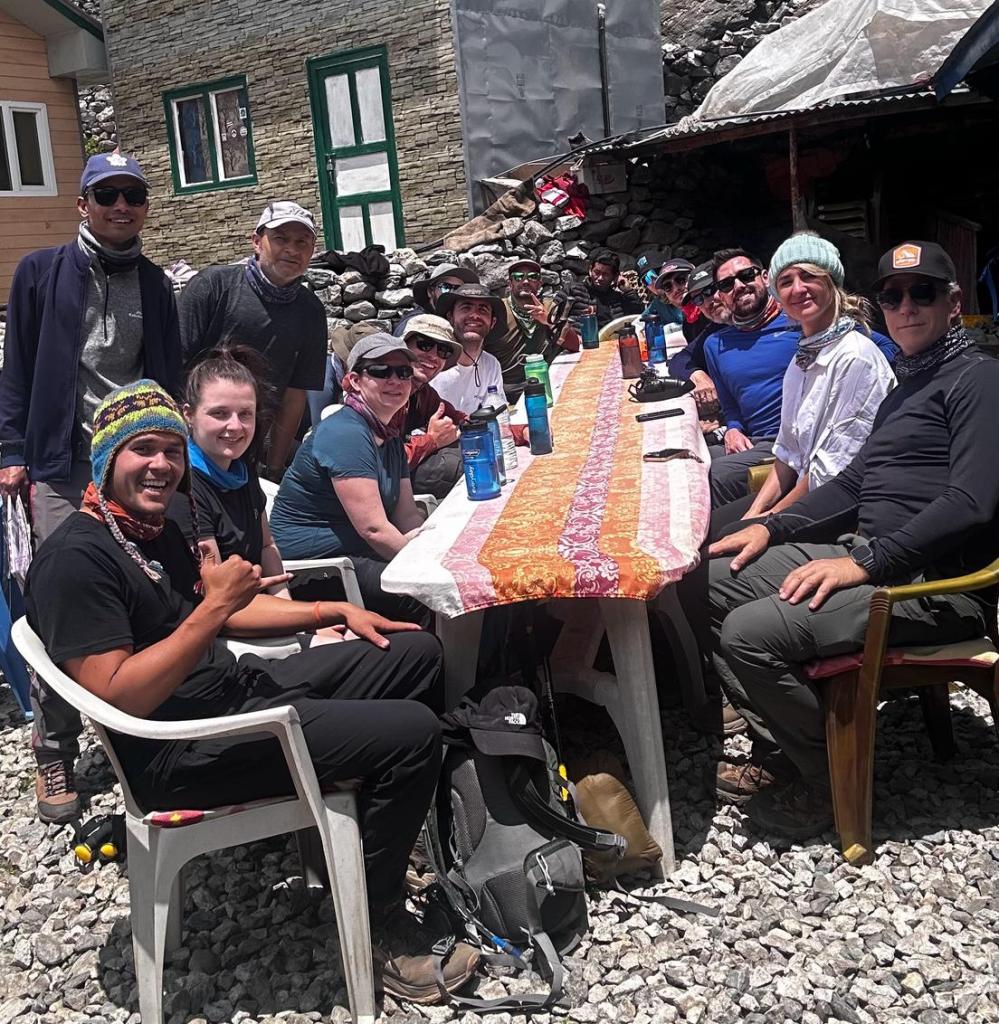
As we deboarded the plane, the fresh air of Lukla hit me and the reality of this adventure set in a bit more. It felt surreal to be walking where everyone who’d sought to conquer Everest started their journey. Our group of 14 gathered in the main lodge where we ordered breakfast, filled up on bottled water, and began the first leg of our trek.
The hike from Lukla to Phakding proved to be a good introductory hike, as it was short and we arrived to Phakding in just over a couple hours, around noon. The weather was humid and cloudy, but the hills could still be seen towering above us, covered in greenery and providing a sense of peace as the Dudh Koshi river rushed beside us. Our group shared a dining area with another trekking group for lunch, something we would grow accustomed to with all the different trekking groups going up and down the Everest trail. We all sat with the people we knew, still familiarizing ourselves with those in our own group and desperately trying to remember everyone’s names. A friendly cat strolled around the room, jumping up on ledges to inspect this new crew of people and jumping back down to make its rounds of saying hello. It warmed up especially to one of the British lads in our group named Ben (we had a British Ben and an American Ben). British Ben had a fascinating backstory – he’d been laid off from his job a week prior to this trek (a circumstance he coined as “voluntary redundancy”), and with the help of a nice severance package, signed up immediately with one week to pack, book flights, and prepare for other adventures he’d potentially have after Everest. As probably the most outgoing person in our group, he had a knack for connecting with everyone and was quite speedy on the trails as well. At this point, it seemed our group was well balanced, and I looked forward to getting to know everyone else throughout the journey.


Day 2 – Phakding to Namche Bazaar (Elevation: 11,286 feet)
Departing bright and early from Phakding, we began our 7-hour trek to Namche Bazaar, a central hub with over a hundred buildings nestled neatly into the rocky mountainside. Our route to get there slithered alongside the powerful Dudh Koshi once again and took us over four river crossings via suspension bridges. After the fourth (and highest) suspension bridge, the incline increased dramatically over the last few miles towards Namche Bazaar. For about an hour I trudged along in silence, waiting to see the picturesque mountain town around every corner. We stopped at a fruit stand during our final break, where two members of our group bought apples (something I wasn’t sure would be safe to eat, but after seeing them buy it, decided it was). The one eating the apple was Grace, a well-traveled Australian who hiked at an impressively fast pace. She had a bubbly personality that brought smiles to everyone in the group, something we all needed during times of fatigue and achiness. Her beau, Curtis, was a Canadian from British Columbia who had a very stoic aura about him, something that made me think of him as the Indiana Jones of our group. A highly experienced yacht caption, Curtis had more stories than I can even remember. The two of them were the only ones in our group who’d been to all 7 continents, a result of their shared love for traveling.


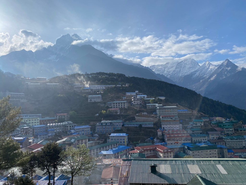
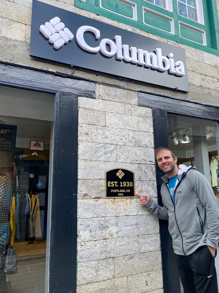
At long last we arrived, feeling relieved that this hub had everything we needed/wanted (hot showers, good cell service, currency exchange stations, even a Columbia store!). At 11,286 feet elevation, Namche Bazaar is just a bit higher than the summit of Mt. Hood (for any Oregonians reading this).
After settling into our hotel, Shankar told us to stock up on whatever we needed here, as there wouldn’t be as many goods available in the villages after this. American Ben, Matt, and I (my main trio) ventured off into the town, stocking up on snacks, various clothing items, and Nepali rupees (some places along the trail didn’t accept credit card which we’d been used to up to this point).
Ben was an avid traveler with a knack for adrenaline and adventure, two things that led him to some awesome places and at times got him into sticky situations. He’d been my roommate most of college and we’d shared some interesting experiences, from hiking through the Sierras in California (where we once hallucinated from dehydration), to getting stranded in the middle of a forest village with no cell service and relying on locals to get us out, to running around in sub-0 temperatures (Fahrenheit) and getting frostbite on our feet. His solo adventures were just as intense, if not more. A risk taker on every level, Ben always had interesting stories to tell. This was one reason I was excited to embark on this adventure with him, along with his friend Matt who he’d met at pilot school. Matt had toured Australia and New Zealand with Ben, so I was excited for the 3 of us to go on this adventure through the Himalayas together. Matt, as I learned throughout the trek, was someone you could talk about anything with, and one of those people you just felt comfortable around. An investment analyst based in Oahu, he surfed every morning and was an ardent reader, someone who loved to learn and wasn’t afraid to present a hot take every now and then. I was thankful to be around these guys during this trek.
Ben and I eventually wandered over to an Irish Pub, which turned out to be the highest Irish Pub in the world. Shankar had warned our group that drinking was not advised on the way up, so inevitably Ben and I ordered Guinness’s (which unfortunately were not on tap). We were joined by two others in our group, a father and son from Mississippi, who essentially lived at sea level and had only hiked up to 5,000 feet as their highest hike prior to this trip – something that caused me to wonder how they’d hold up on this trek. However it appeared they were hardly phased, as they joined us for a beer where we talked and got to know each other better (only later did we learn the father was puking his guts out the night we landed in Lukla, but no one was the wiser). Alex (the son), who’d just graduated from Ole’ Miss a week or so prior to the trek, had his degree in chemical engineering and was in a rotation program to help launch his career. His father, George, was a physical therapist and also an incredible guitar player. Having them on the trek made me think back to my own trek with my dad hiking Mt. Kilimanjaro. I had fond memories of that and knew this trek would result in the same for George and Alex. After proudly finishing our beers and paying the tab, we returned to the hotel where we relaxed until dinner – which would prove to be quite humorous.
This was the first night where oxygen tests were given to ensure our O2 levels were normal for the elevation we were at. Most people scored around 89-95%, however the youngest in our crew, a 19-year old British kid named Cameron, scored a percentage that caused the guides to question his blood alcohol content. Heads slowly turned as we noticed Shankar giving Cameron the business – he’d had two beers before dinner which skewed the oxygen test. The banter between Cameron and Shankar was a treat that no one wanted to miss out on, as both were quick-witted and didn’t shy away from any argument, no matter how petty it was. Cameron, with his thick English accent and quick wits, struck me as a mix between Ricky Gervais and Russell Brand, while Shankar had a sense of sarcasm so high it took me half the trek to figure out when he was joking or not. “You need to limit drink above 3,000 meters” Shankar told him, to which Cameron responded, “Okay…so what is the beer limit above 3,000 meters…?” The young Brit had the whole crew laughing as we got ready for bed.

Day 3 – Hike to Syangboche (Elevation: 12,467 feet)
Having gained roughly 3,000 feet in elevation from Phakding to Namche Bazaar, our third day was an “acclimatization day,” where we stayed at Namche Bazaar and did a relatively short day hike to keep us moving and acclimatizing to the thin air. I woke up feeling a little dizzy from the altitude, but some warm ginger tea gave me the boost I needed to do the hike (as the late Scott Fischer said, “It’s not the altitude it’s the attitude.”). I was also encouraged by talking with Brad and Jessica, the only married couple in our group who I really hadn’t talked to up to this point. I asked how long they’d been married, where I was wildly shocked to hear “a couple weeks” – this trek was their honeymoon! I felt honored to be part of such a memorable experience for them and was inspired by their shared sense of adventure.
The trail from Namche Bazaar took us to an awesome view point where, for the very first time since arriving, we saw a glimpse of Mt. Everest. It poked its head above the clouds (which hid majority of the mountain), but the peak was all we wanted to see. Everyone stared in awe for about 20 minutes, taking in the legendary peak that towered 18,000 feet above us. It boggled my mind that Mt. Rainier could’ve been placed right where we were standing, and it still would’ve been 4,000 feet shy of Everest.
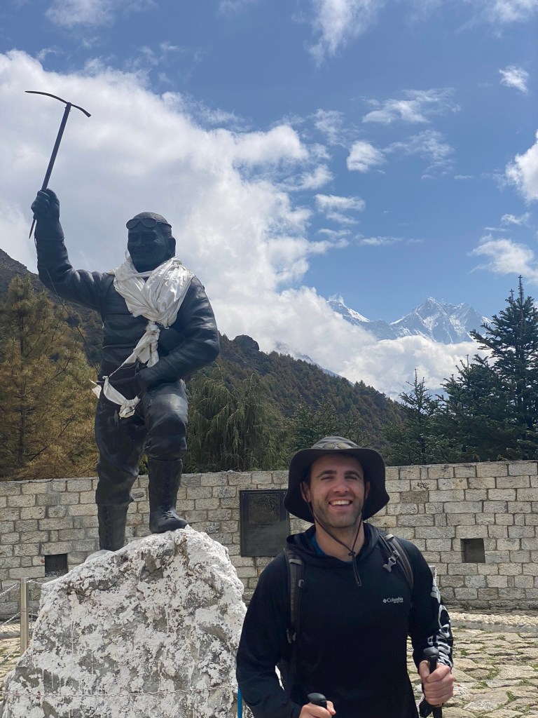
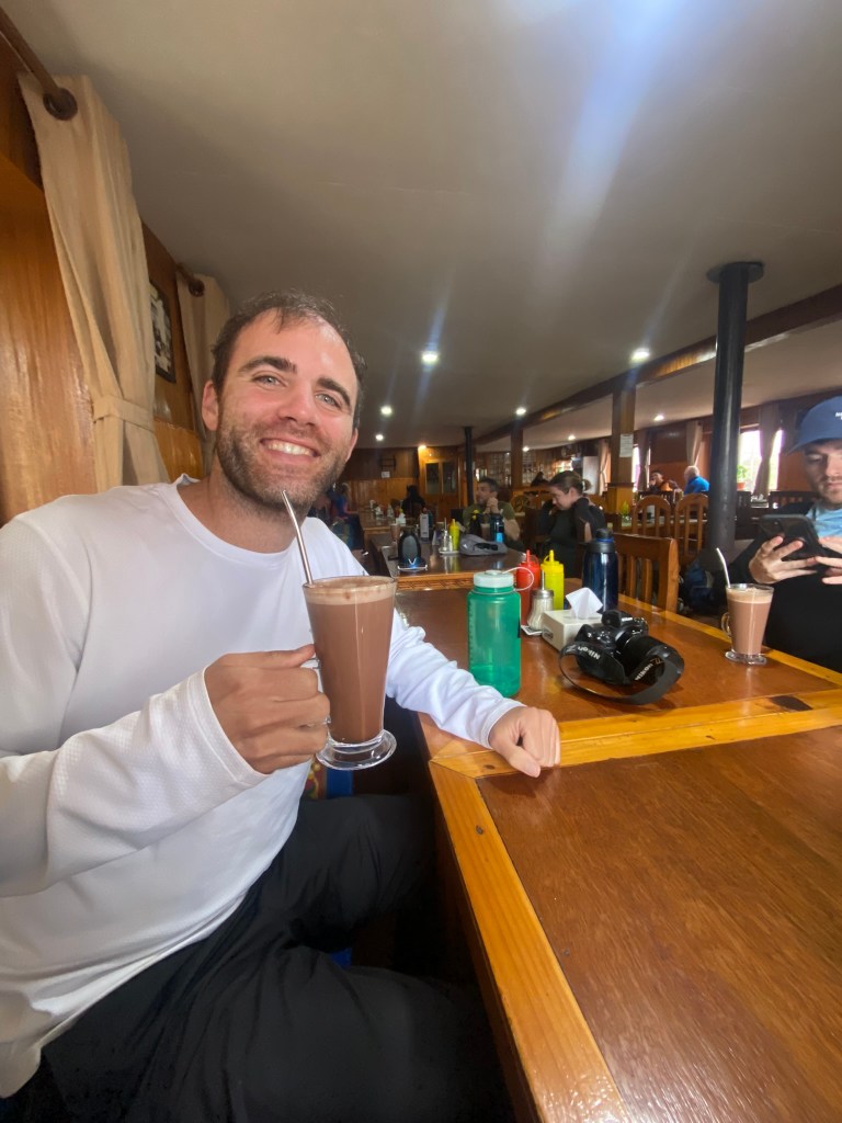
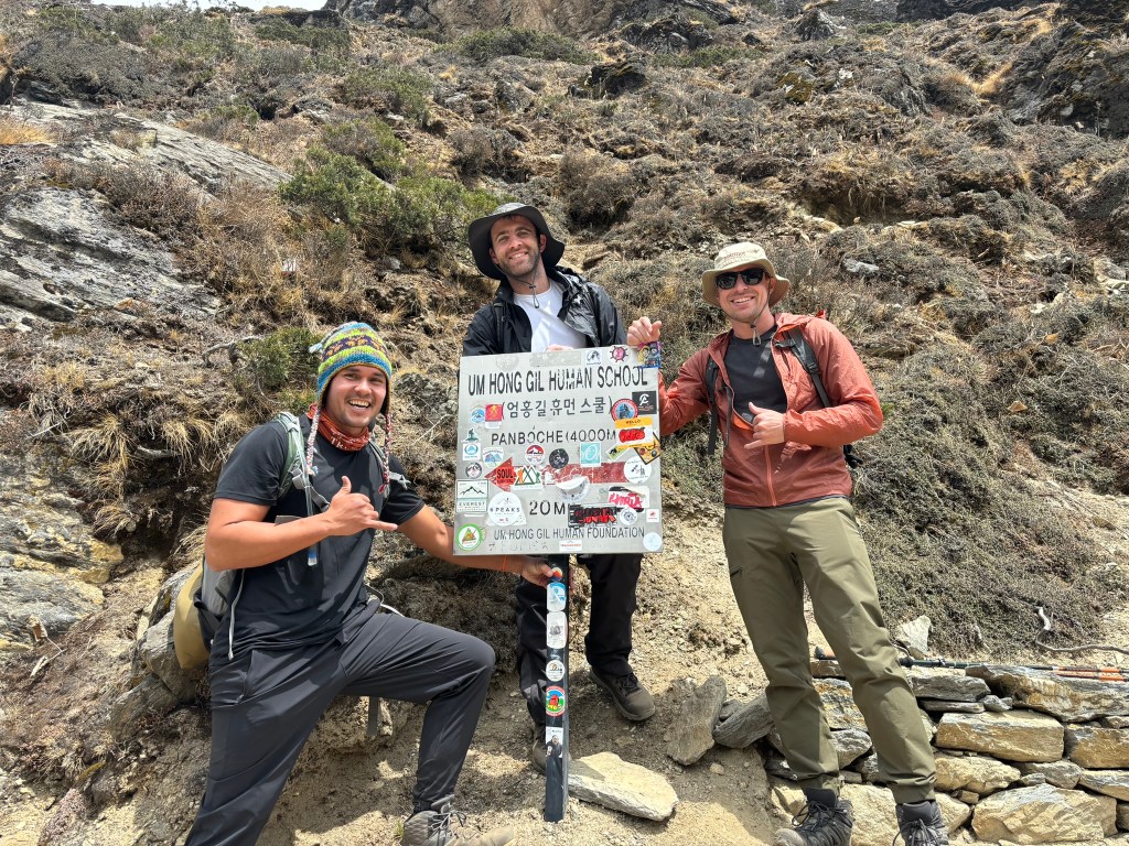
Finally, we came to and hiked up a ~1,000 foot hill at an easy pace, bringing us to an Everest visitor center at the top along with a café (where I happily ordered hot chocolate). Fellow tourists and trekkers scoured the visitor center, browsing through the various signposts, landscape models, and artifacts. We watched a short film on the efforts being put forth to help rid Everest of the endless trash that littered it – empty oxygen tanks and abandoned tents at the upper camps were hard to dispose of at such high elevation, but anyone could help pick up small wrappers and bottles that lined the trail to base camp. Special lightweight trashcans had been made for volunteers to pick up trash along the way if they wanted, and the Nepali people created trinkets with recycled bottle caps that could be purchased as well. There were also virtual reality headsets we all put on, which took us directly to base camp and the upper camps of Everest. After perusing all the visitor center had to offer, we descended back to Namche Bazaar, where we prepared to continue on towards our next camp.
Day 4 – Namche Bazaar to Tengboche (Elevation: 12,664 feet)
At this point my mental capacity seemed to drop to around 75%, as I didn’t feel quite all there. I found myself forgetting fundamental things, like what time we needed to be packed each morning (something our guides repeated to us each night) – overall it just took more energy to think. Despite that, I felt physically ready to move forward to our next destination. The first 3 quarters of our trek to our next village, Tengboche, was mostly flat and also downhill, a welcome reality that put the crew in a chipper, positive mood. The trail curved along the Dudh Koshi once again, this time about 2,000 feet above it and hugging the hillside of the valley. The valley itself seemed to be a helicopter highway, as we saw 10-15 helicopters fly through it towards Everest, transporting supplies. While the cloudy weather kept the sun from beating down on us, it also blocked the scenic view of Everest that we would’ve had for over half the hike.
We shared the trail with several yaks making their way up and down the trail as well. Each time we saw a large group of them, we’d stop for water and let them pass. It was mesmerizing to watch them slowly trekking along in their very calm demeanor. The trail eventually took us to the bottom of the valley where we had lunch, and where we knew it was all uphill to our final resting spot for the day. Upon arriving, we happily took our seats in the dining hall (where I of course ordered hot chocolate).


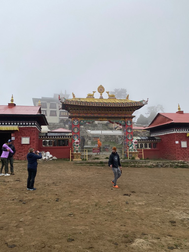
Shortly after arriving and settling in, we visited a Buddhist monastery directly across from our teahouse, where monks prayed 24 hours a day. It was the Tengboche Monastery, also known as Dawa Choling Gompa, one of the most famous Buddhist monasteries in Nepal. Upon entering, there was a sign with nine rules listed, only three of which I can remember: no shoes, no photography, and no kissing. Prayer chants echoed throughout the halls as we prepared ourselves for some serious meditation. The chants grew louder as we entered the main sanctuary, yet the ambiance in the room was serene and quiet. An aroma of incense filled the room, further enhancing the majestic atmosphere. Colorful tapestry hung across the walls, while intricate woodwork, colorful paintings, and Buddhist symbols decorated the doorways and windows. The floor was covered with traditional carpets and prayer mats where the monks sat and prayed. We were directed by our guides to sit on a long mat on the very edge of the room, where we sat cross-legged taking in prayers that were so sacred to the monks. After about three minutes of sitting there, the room went dead silent – I could hear my wheezy breathing which I quickly tried to secrete. The silence pierced the room as our guides sat with us, eyes closed in prayer. After about two long minutes, the chanting continued, at which point we stood and left.
Day 5 – Tengboche to Dingboche (Elevation: 14,470 feet)
The dreadful feeling of a hot fever hit me as I woke, along with a headache that had my head feeling like a concrete block. Ben also woke feeling feverish and with a sore throat. However, upon entering the dining hall for breakfast with the crew, we were quickly assured we weren’t the only ones feeling under the weather – several coughs and sniffles could be heard around the table. The majority of us had fallen victim to the inevitable spread of foreign germs and bacteria floating around the tea houses, but even so, the mood of the group remained positive. The trusty elixir of ginger lemon tea, honey, and Ibuprofen had us all feeling a little better by the start of our hike.
The hike began with trees lining the trail, a luxury we would no longer have by the end of our day. We followed the path along the Imja Khola river, which led us to the one and only crossing bridge of the day. Shortly after the bridge we reached a celebratory sign post, indicating we had reached the 4,000m elevation point of our journey (~13,100 feet). We were now above tree line, with only shrubs and rocky soil surrounding us in the high mountainous terrain. Everything seemed to be a shade less colorful now, inviting an eerie yet exciting feeling that we were actually getting closer to Everest base camp. Unfortunately, we once again experienced cloudy weather, eclipsing the majestic views of the Himalayas we were very much hoping to see. Shankar was visibly disappointed – “This weather is shit” he told us.
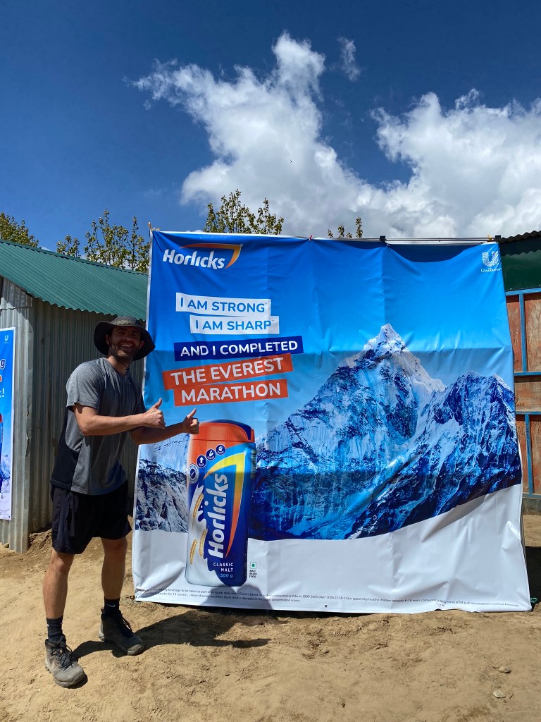
Despite the gloomy weather, we shared the trail with marathon runners preparing to run the Everest marathon on May 29th, an event I didn’t know existed. The highest marathon in the world, it starts at Everest base camp and ends at Namche Bazaar, and is held on May 29th since Everest was first officially summited on May 29th, 1953. As a runner myself, I couldn’t help but give these runners mad respect, as these were elite trail runners running 3 miles above sea level. They were, quite literally, next level.
After gaining nearly 2,000 feet in elevation, we reached Dingboche, a fairly large settlement tucked between treeless hills which were sprinkled with ubiquitous green shrubbery. Shankar had warned us our teahouse here would be minimal, with holes in the ground for bathrooms and very limited supplies. I thought back to my experience at Kilimanjaro and mentally prepared for such conditions, especially when it came to the bathrooms. Alas, a jokester at heart, Shankar was amused by our reactions as we arrived to find relatively good bathrooms, large bedrooms, and a well-heated dining hall with a good number of supplies. Shakespeare once said, “Expectation is the root of all disappointment.” Well, Shankar made sure to keep expectations low so we would never be disappointed.
As we gathered in the dining hall waiting for dinner, American Ben asked the group if anyone had any hidden talents. We agreed to go around the circle and share, but no one was too enthusiastic to start – eventually Ben was asked to share first. Without hesitation, he revealed his hidden talent was playing the penny whistle. “I can play the Lord of the Rings theme song” he proudly announced, eliciting a “Well let’s hear it then” from someone in the group (probably Cameron). A loyal student to the penny whistle, Ben got up and ran to his room where he had his penny whistle in his bag for this very scenario. Upon returning, he played the tune which brought out applause from the group (this was just the beginning of many great surprise penny whistle performances in the trip). With the tunes providing newfound energy for the group, whispers could be heard amongst our guides, bashfully laughing and pointing towards one of their own. Our assistant guide Raj was then asked to share his hidden talent, where after some convincing, he performed a dance that also resulted in applause. Up to this point we’d all been relatively formal with each other, but it was moments like these that brought out the unique personalities of people and helped us all get a little more comfortable.


Day 6 – Acclimatization Hike (Elevation: ~15,400 feet)
Similar to our stay at Namche Bazaar, we stayed at Dingboche two nights to acclimate before moving on. For our acclimatization day, we embarked on a short hike that took us up to ~15,400 feet, a height I’d only been to once before and for many the highest they’d ever been (a true Samwise Gamgee moment for most, for any Lord of the Rings fans reading. Sidenote: Nearly every morning I woke up, I put on Lord of the Rings music to start the day, a euphoric experience in the Himalayas). Everyone seemed to be feeling much better today – our spirits were even more uplifted by the warm weather and views of snow-capped mountains peaking through the clouds, one of which was Lhotse (the world’s 4th highest peak that shares the South Col base with Everest). As I was hiking up, I heard a sudden series of gasps from somewhere above me on the trail. I was bringing up the rear of the group that day and wondered what had happened to elicit such reactions from above. I came to find out that Mike, a fellow American from Connecticut, had done a handstand on a picturesque rock ledge, but had then fallen off for what appeared to be a 7-foot drop. Thankfully he landed on his feet which helped break the fall, where he then tumbled a few more feet down (the whole thing was caught on camera). While he very well could’ve gotten injured, or even just laid on the ground to collect himself after such a fall, he immediately got back up and walked back up to where he was. As the great Batman / John Wick says, it’s not how many times you fall, but how many times you get back up. Mike’s resiliency on the trail and in his own life was something I respected.
After snacking for around 20 minutes at the top of the hike, we descended back down to our lodge where we ate lunch and watched the documentary 14 Peaks as a group. Later that night, British Ben hosted a trivia night for anyone who wanted to participate. He broke the questions up into four categories: General Knowledge, Geography, Sports, and a wild card category which happened to be Disney. Unfortunately my Disney knowledge failed me, as I left the room one hundred rupees less than when I’d walked in. The winnings went to Nicole, a Canadian who was the only other person in our group to have hiked Mt. Kilimanjaro, something we were able to connect on from the start of the trek.
Day 7 – Dingboche to Lobuche (Elevation: 16,210 feet)
The group seemed to have found its second wind, as we started the day off strong, powered by sunlight and the best views we’d seen so far. Ama Dablam poked its head above the clouds, looking down on us as we departed Dingboche beginning our trek through the high alpine terrain towards the much anticipated Khumbu glacier. Helicopters roared through the region once again, a normality we’d grown accustomed to after seeing/hearing them for several days. While our group remained strong, we walked about half the pace we’d normally done up to this point, a result of the altitude and gradual incline that never seemed to level off.
During one of our water breaks, an Everest Marathon group passed us, and a guy wearing a “California International Marathon” shirt caught my attention. Approaching him, I just said “CIM?” He nodded and asked if I’d done it, to which I nodded back, telling him I was tentatively planning to do it again in 2024. After a couple more brief exchanges, he continued up the trail.
Around the 15,750 foot mark, we reached a memorial site dedicated to climbers who’d lost their lives, either on Everest or elsewhere. The flat foreground displayed several stone tower monuments with plaques giving a small summary of the climbers’ endeavors, along with their birth year and year they died. Scott Fischer and Rob Hall were two significant plaques to me personally, as they were the main mountain guides who died during the 1996 Everest disaster (where a total of 12 deaths occurred). Rob Hall’s plaque showed just his name and nothing else, something that elicited a strange feeling of disappointment to me. The legendary mountain guide risked his life to save one of his clients, ultimately dying on Everest with a daughter on the way. Perhaps I was biased from reading about him as the protagonist in Jon Krakauer’s controversial “Into Thin Air” account, but I felt he deserved a better plaque.
I saw the CIM runner again at the memorial site, this time with American Ben. He confirmed he was running the Everest marathon in a few days, on May 29th. While it was a downhill course, it presented the risk of rolling ankles on the loose rocks strewn out along the Everest base camp route. He expressed nervousness around that, but otherwise appeared fairly calm. We departed with a fist bump and wished him luck.
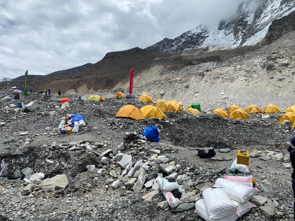
Finally arriving to Lobuche, we gathered inside for warm tea and hot chocolate. However, rather than resting for the day like we had on previous days, Shankar encouraged us to do one extra short hike up a ridge that would take us to ~16,500 feet. This would optimize the acclimatization process and give us our best chance to make it Everest base camp the next day. At the top of the ridge, we could see the tiny village of Lobuche where we were staying. And in the opposite direction, we could just barely see tiny yellow dots at the foot of a giant glacier – Everest Base Camp.
Day 8 – Everest Base Camp (Elevation: 17,598 feet)
Today was the day. We awoke with a renewed sense of vigor as the morning darkness surrounded us. We’d all experienced some level of sickness up to this point, but today was not the day we’d cave to it. Ben, however, had the worst sleep (or lack thereof) in his life, waking up several times throughout the night gasping for air and violently coughing. He downed 600mg of Ibuprofen (above the max recommended limit) in a desperate attempt to find instant relief. In tandem with this, he played a motivational speech from none other than Jocko Willink, a retired Navy Seal whose mantra “Discipline equals Freedom” has influenced many during a time of need. “I am weak…but…I do not accept that. I am fighting. I’m always fighting, struggling, scraping, and clawing at those weaknesses…to change them, to stop them…as I strive to be…just a little bit better today.” We couldn’t help but chuckle at the overly serious tone in the recording. Ben played these speeches prior to any difficult endeavor, be it a marathon, a hike, or even a date. As we finalized packing our belongings to start the day, British Ben broke out into a macarena dance, lightening the mood and giving us good mojo as we departed.
Leaving Lobuche at 4:30am, we made our way to Gorakshep, the closest mountain village to Everest base camp. The early morning light revealed clouds amidst the mountains once again, giving us a sinking feeling we might not see Everest after all (it made me think of Portland visitors who sadly never get a glimpse of Mt. Hood because it’s covered in clouds the whole time). After a few hours though, we were relieved to see the clouds burning off and found ourselves in a large bowl-like valley with the Himalayas showing off for us. It was a majestic moment that I cannot adequately describe or give justice to. Even with the clear views though, Everest was still hiding behind Lhotse. After taking in the scenery, we continued towards EBC, in hopes to see Everest itself.


We stopped at our lodge in Gorakshep around 8am to acquaint ourselves with the rooms and have a light meal. We’d be returning here for the night, but at that moment this was just a rest stop as we continued towards EBC. After about an hour, we continued onward.
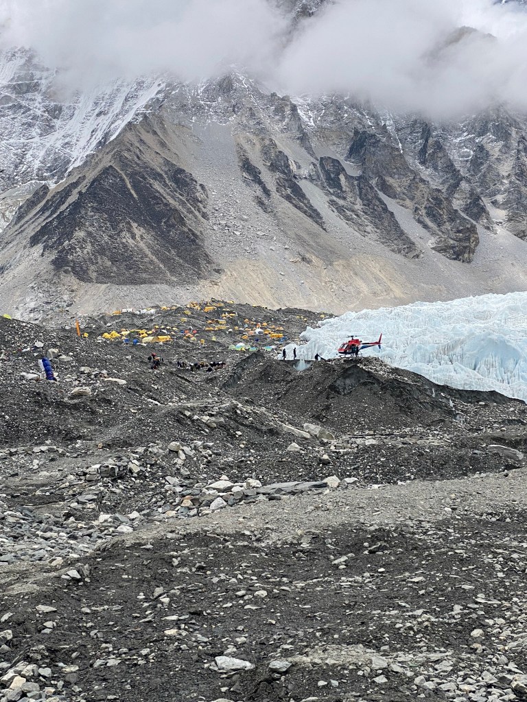
A series of turns in the trail brought EBC into view – a sprinkle of yellow dots next to the giant Khumbu glacier that served as the path to Camp 1 of Everest. The path we were currently on though was rocky and hilly, slowing our pace even more and making EBC feel so close…yet so far. It was one of those feelings where we thought more progress was being made than realistically was. Visually, the distance seemed to remain the same no matter how much time passed. It was during one of these times that our guide pointed out the top of Everest, peaking out over Lhotse. I stared at it as we continued walking, hoping I wouldn’t trip and sprain my ankle. It was majestic, intimidating, awesome and terrifying all at the same time. It attracted people from all over the world, unifying them in a way only it can, yet costing so many people their lives, people who’d started off motivated and inspired on the very trail we were on. One topic our group had discussed was if we would attempt Everest given money and vacation time were not factors…I was torn on this, as it offered as much adventure as it did terror.
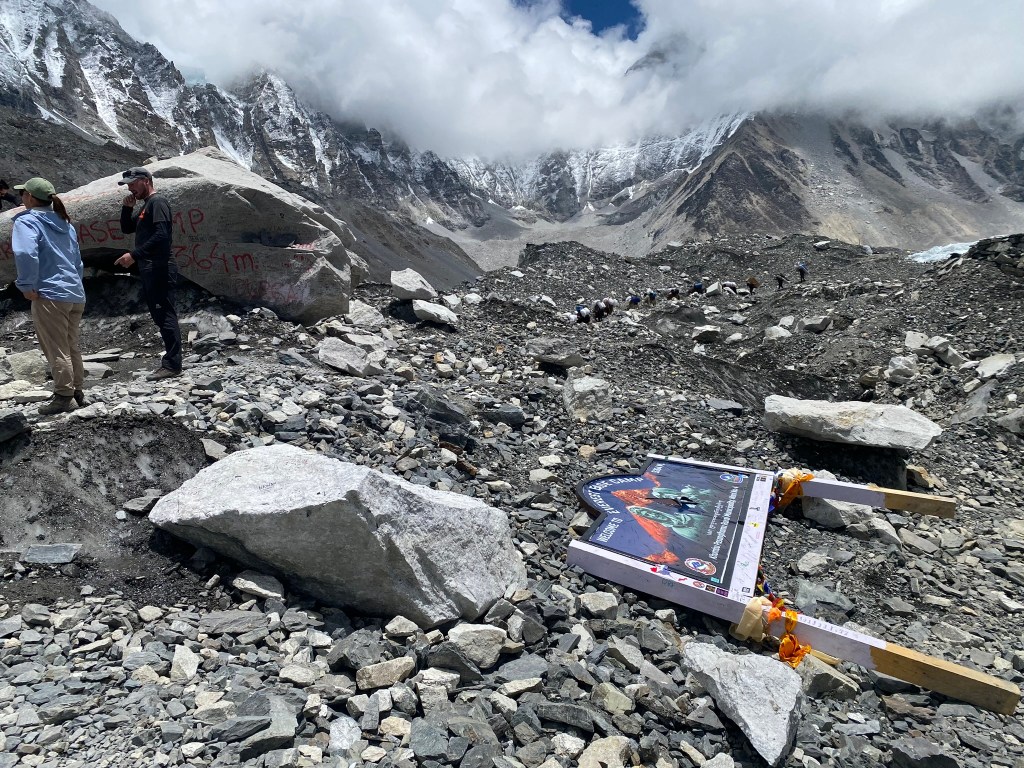
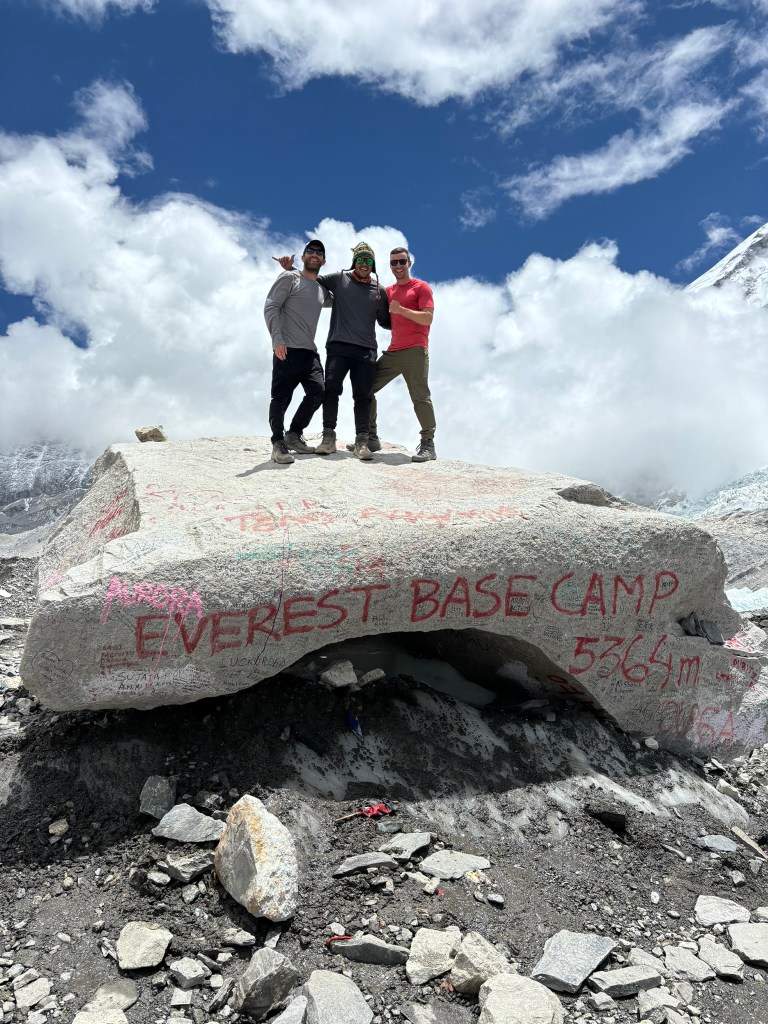
Finally, at long last, we arrived at EBC. Everyone exchanged hugs as we took turns taking photos on the famous Everest rock spray painted in red. I’d expected to see the new (and lame) Mt. Everest sign directly in front of the rock, essentially blocking it (this new development had a lot of people up in arms, as the Everest rock was iconic and was now blocked by the sign). But upon arrival, we found the sign ripped out of the ground laying flat next to the rock, no doubt an act of rebellion from Everest purists at base camp (well, that’s at least my theory).
Despite the celebration, I was bummed we weren’t allowed to go too far into base camp, as the guides didn’t want us staying there long due to people getting altitude sickness at the camp’s high elevation. Unfortunately, the elevation took its toll on Grace, as her blood oxygen level dropped to 60%, an alarming percentage even for Everest standards. An avid hiker, she made it back down to Gorakshep before any of us even knew she was gone, where her and Curtis were helicoptered off to Lukla to recover. While it was a bummer to lose both of them for the return journey, I was thankful we’d all made it to base camp, with all 14 of us stacked atop the famous Everest rock.

Day 9 – Gorakshep to Kalapathar (Elevation: 18,519 feet); Kalapathar to Pheriche (Elevation: 14,341 feet)
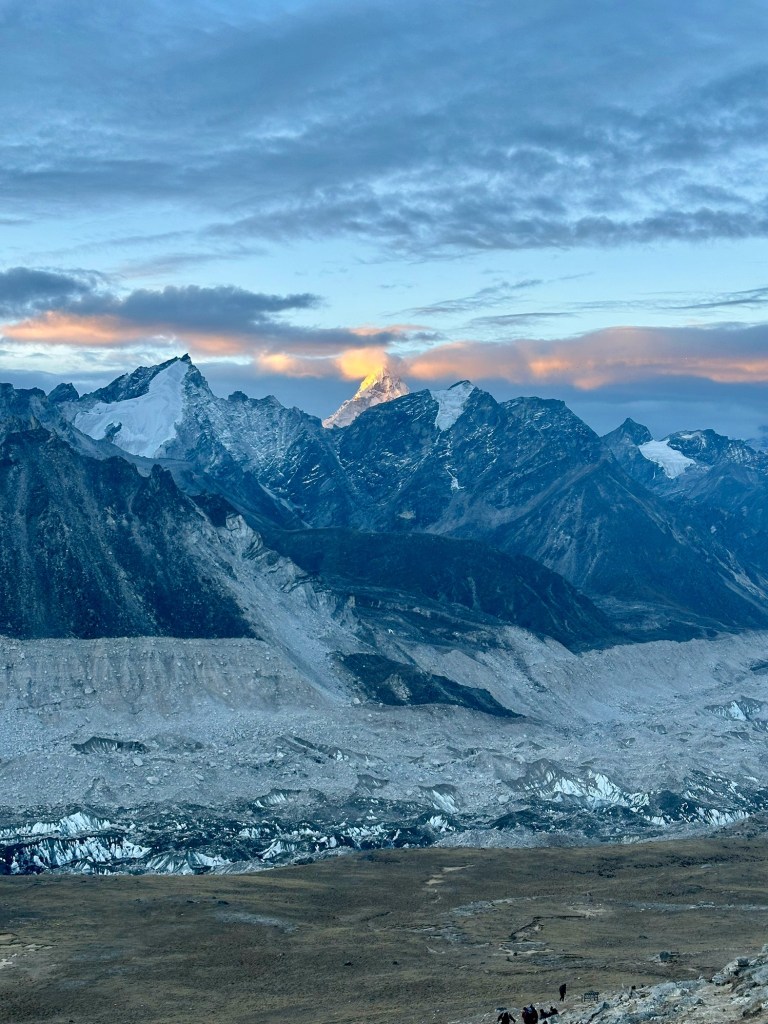
While we’d reached the destination we all signed up for in EBC, it was not the final destination; in fact, it wasn’t even the highest destination. After a long and arduous day hiking to EBC and back from Gorakshep, the next day offered an optional hike to the top of Kalapathar, a high rocky ridge providing the best panoramic views of the Khumbu valley. About half our group decided to go for it, with a wake up call of 3:30am. I was pleasantly surprised to find it was not too cold when we first started, but it was dark. It felt reminiscent of the summit hike up Mt. Kilimanjaro, with headlamps appearing as small white dots high above in the morning darkness and no view of the top in sight. We followed every footstep of our guide Raj, making sure to go his pace and take in every piece of advice he gave. After about 45 minutes of steep incline and thinking we’d made good progress, we asked Raj if we were halfway there, to which he chuckled and shook his head (aka “no”).
As the sun rose and began illuminating the valley, we saw more majestic views, including the best view of Everest we’d seen so far. We stopped to look at it in awe once again…it just stood there, so peacefully on a beautiful calm morning, inviting anyone who dared to attempt a summit. No one would be summiting today, despite the perfect conditions, since it was too late in the season. As I looked on, I thought of all the bodies the mountain had claimed – a morbid thought, yet one that, to me, had to be considered by anyone hoping to summit. It still felt surreal looking at it with my own eyes.
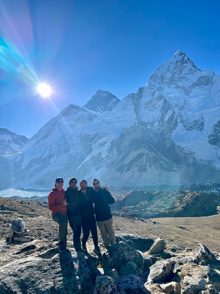
Both Bens and I summited Kalapathar at 18,519 feet, about 1,000 feet higher than EBC and just 800 feet lower than Mt. Kilimanjaro. The stunning views helped distract me from the lack of oxygen we’d all been suffering from – it was comforting knowing the rest of the trip was literally all downhill from here.

The four of us (including Raj) descended Kalapathar and regrouped with our team back at Gorakshep. Around 8am our whole group departed for Pheriche, a small mountain village known for its prestigious medical clinic for trekkers. We walked at a good pace, thanks to the gradual downhill we’d now have for the remainder of the trek, and arrived around 2pm. This village was of particular interest to me since Jon Krakauer spends a good amount of paper describing it in “Into Thin Air” (we had a physical copy of this book with us to reference the various villages as we went along – it’s cool to me how much a book comes alive when you’re in the location(s) it’s describing). It was interesting how during the time of the expedition from the book (1996), the Khumbu glacier was 12 miles long, extending from Everest all the way to Pheriche, the village we were currently in. Now however, in 2024, the glacier is non-existent until the very base of the mountain, causing discussions of Everest base camp being relocated since it’s built on the glacier. It just made me think of how big a difference ~30 years can make. If the Khumbu glacier continues to melt at a rapid pace, it’ll be interesting to see what adjustments are made to routes going up to the Everest summit.
Day 10 – Pheriche to Kenjuma (Elevation: 11,450 feet)
We hiked below tree line for the first time in five days, a welcome feeling for all of us as we took in relatively thick air again. The trek to Kenjuma was very up and down, with the trail dipping down to the river only to rise back up to the hillside of the valley. The weather brought a thick fog that blocked any potential views of mountains in the distance. However, having already seen the amazing sights from the past few days, we were just happy to be making good progress on the backend of our journey.
We played trivia again that night, with the same 3 starting categories: General Knowledge, Geography, and Sports. The wild card category this time however was Harry Potter, so I knew I’d do better than last time. Even still, I finished second to Nicole (apparently also a Harry Potter nerd) who once again won the pot. The fun part of trivia though was the trivial debates it created afterwards. One such debate was whether a Pringle should be considered a “crisp” or “biscuit.” Clearly, such a dispute was started between the Europeans of the group, as the Americans all agreed Pringles are coined correctly as “chips.” Nonetheless, Cameron argued Pringles were “biscuits” by definition, while Miriam argued they were “crisps.” Miriam, a nurse from Whales, was a soulful character with a caring and joyful personality. But she did not back away from any challenges, whether it was hiking a steep hill or a debating on what Pringles were. The banter escalated to shouts across the dining room, providing great entertainment for the crew. Alas, who won the argument? Neither of them, because Pringles were invented in America and are chips.
Day 11 – Kenjuma to Chumoa (Elevation: 9,186 feet)
It was the day of the annual Everest Marathon, an event we were lucky to be overlapping with during our trek. We started the day off late to align the timing of our hike with the top finishers of the marathon at the finish line. Essentially, we would get to Namche Bazaar (where the finish line was) around 10am and wait for the first few finishers before continuing to stay at Chumoa.
We arrived at Namche Bazaar in good time, enjoying the amazing views along the way we didn’t get a chance to see going up due to the cloudy weather. Looking up at Ama Dablam and Everest from below tree line was one of the most majestic views I’ve ever seen. It was a clear sunny day, yet not too hot – perfect conditions for the runners who were so ambitiously running from Everest base camp (17,598 feet) to Namche Bazaar (11,286 feet). Having just trekked most of the course, it was incredible to think these people would be running across terrain I could hardly walk through – jagged rocky slopes, limited flat sections, not to mention the elevation – all made for an extremely difficult course. We waited at the finish line for about an hour, anxiously awaiting the first runner to cross the finish line. Cheers and applause filled the small finish area as the first runner broke through the red tape. A Nepali native, he finished in 3:48, a time most people would be proud of on a flat course at sea level. I looked at him in awe, admiring his accomplishment of completing one of the hardest marathons in the world at such an elite level. After the second runner came through (another Nepali), we continued on our way to Chumoa.
During the final leg to Chumoa, I felt an increased burning sensation in my inner thighs from a rash I’d developed overnight in Pheriche. Throughout the day, it spread down my legs all the way to my feet, then up across my torso along my shoulders, arms, and hands. My now splotchy red skin was no doubt an allergic reaction to something I’d been exposed to in the last 12-24 hours, but I couldn’t quite figure out what it was. With two nurses in the group plus Matt, who were all well equipped with medical supplies, I was provided topical treatment and Benadryl to help prevent the rash from getting worse. We speculated it was one or more of the chemicals used in the cleaning supplies of the beds in Pheriche. Whatever it came from, I hoped it would go away sooner rather than later.
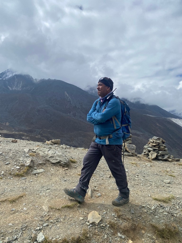
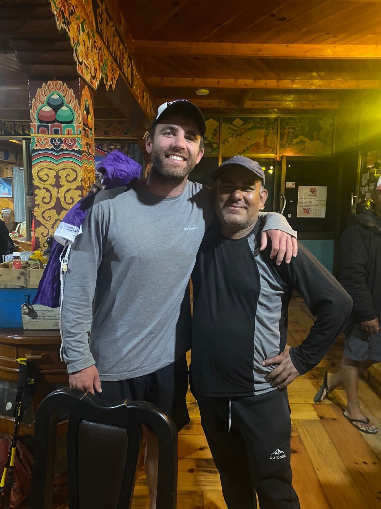
Finally arriving at Chumoa, we set our bags down in our rooms and went back outside to play volleyball with our porters and guides, who we learned were quite good. It was a fun time for everyone, despite playing in hiking boots and developing minor blisters on our heels. After my team retired as king of the volleyball court (nbd), we moved on to the dining hall, where our guide Shankar was sitting down with an open chess board, waiting for someone to play him. I made eye contact with him – “You, play?” he asked. “Sure” I replied. He’d beaten someone earlier in the day, so I was curious how I’d hold up. After making a mistake with his queen, and thus losing it, I beat him fairly handily. “Rematch!” he exclaimed about 15 minutes later. “Sure,” I replied. This time I was the one who made a crucial mistake, something he couldn’t stop laughing at as he beat me handily for our second match. “Tie breaker game” I said, which he happily agreed to. Our third and longest game had momentum going back and forth, until I ultimately toppled his king. “Congrats man, but…I let you win – I want good reviews,” he said with a smirk as he walked away. The guy always had the last laugh, a trait that made him an amazingly entertaining guide.
After dinner, I was ready to wind down and get ready for early bed as usual during this trek, but our lively group had other ideas – Chumoa sold rum at a good price, and being on the back half of the trek, it was time to celebrate. Most of us cheered with a shot, which was enough for me, but not enough for some of the others (ahem the Europeans) in the room. Even Shankar was partaking, as he could not have cared less what we did now, having already made it to EBC (a reminder he gave us often on the way up – “I do not care what you do on way down, but on way up, you follow my rules”).
After a few drinks, Cameron stood up, took his shirt off, and walked to the front of the room, as if to make a speech. “EVERYONE” he shouted (the room, shared between our group and another group, was full of about 40 people). “I’d like to teach you a little chant” he said in his British accent. After teaching the chant (something along the lines of “ahhh-tiki-tiki-tonga”), he demonstrated exactly how to say it and added that the goal was to get louder each time…we began in whispers, looking around at others in the room, and slowly increasing our volume over the span of 10-15 minutes. By the end, everyone was shouting as loud as humanly possible, in unison, as if ready to burst out of the building and run into battle. A symbolic moment of victory and celebration, it was something that unified us in a fun way amongst ourselves and with the other group.
After hanging out for a bit, I made my way to bed. Later on, around midnight, I woke up to the sound of vomiting, eliciting a feeling a gratefulness that it wasn’t me, while also feeling happy for those who were letting loose. As I fell back asleep, I didn’t realize what I would find under my pillow when I woke up.
Day 12 (Last Day) – Chumoa to Lukla (Elevation: 9,383 feet)
“Dustin, I’m only waking you because there’s a giant spider above your head.” My eyes opened as I woke to an urgency in Ben’s voice I’d never heard before. Jumping out of bed now fully awake, I looked up behind me to find the largest spider I’d ever seen slowly making its way down the corner of the wall towards my pillow. Almost as if knowing it’d been spotted, the spider froze, challenging us. We had no idea if these spiders were poisonous, but Ben guessed probably not because of their size (thankfully he was right). But we still didn’t know how fast they were when threatened, or if they jumped. I grabbed the only weapon I had, my Birkenstock, to try and kill it. I also opened the door to our small room in case we needed to make a quick escape. But then, in the most uncanny timing, our assistant guide Durga showed up, making his usual rounds of wake-up calls. After a short glance into our room, he told me to give him the Birk. I did. With little to no effort, he casually killed the spider as it fell onto my pillow that I’d been sleeping on not five minutes earlier. He then removed the pillow, where yet another giant spider was hiding…I didn’t want to know how it got there. Sometimes ignorance truly is bliss. Sidenote: there is video footage of all of this. Please inquire if you’d like to see.
After thoroughly checking our bags for any last hidden creatures, we began our last day of trekking, which also turned out to be the hottest. I couldn’t tell what was a sunburn or rash on my skin anymore, but put sunscreen on regardless to try and avoid any further damage. The rash was a little better now, but still culminated a burning sensation when agitated from too much friction. I started doubting whether I could even enjoy a massage anymore, which most people were looking forward to once back to Kathmandu (I did end up getting my first ever facial, but had to skip the 90-minute massage for just $25 USD due to my burning skin).
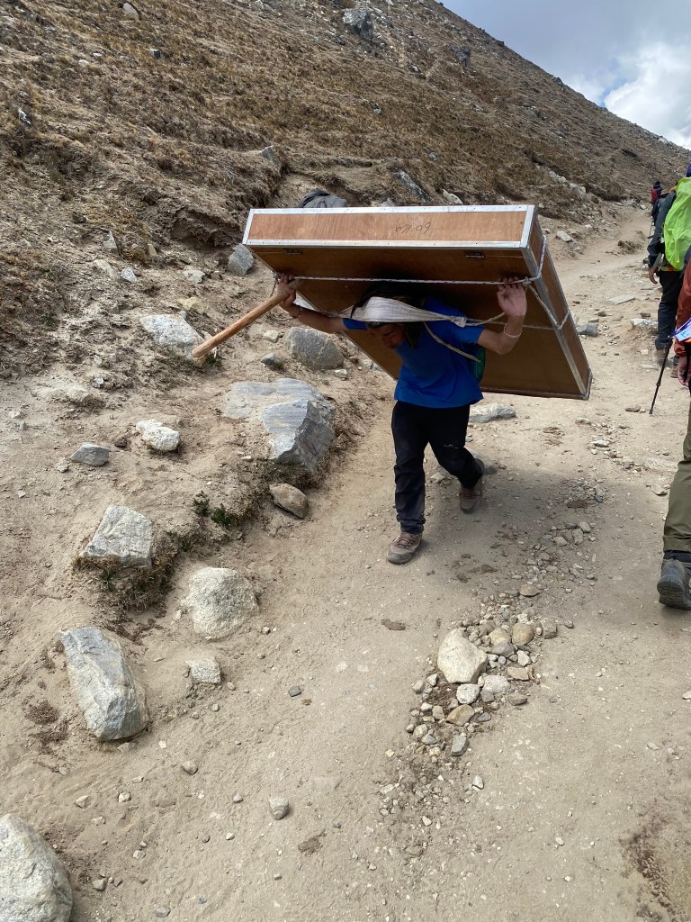
We stopped frequently for water breaks in places we’d stopped during our first trekking day, when we all hardly knew each other’s names. It was a surreal feeling, knowing how far we’d come and the bond we’d created in a little less than two weeks (in fact, some people seemed far too comfortable now). We’d helped each other through sickness and joyfulness, the good times and the bad. Our group was a melting pot of characters, from a father and son, to newly weds doing this trek as their honeymoon (mad respect), to a guy who’d signed up for the trek a week before (after losing his job). 6 Americans, 4 Canadians, 1 Australian and 3 Brits, along with our 3 Nepali guides and 5 Nepali porters, we made for a pretty awesome group.
Finally, we made it back to Lukla, where we stayed one more night before flying back to Kathmandu and saying goodbye. It was a bittersweet feeling knowing our journey was coming to an end. As we ate dinner in the very dining hall where we began day one, speeches were made and tears were shed. As I journaled that day, I felt even myself getting emotional, looking back on the memories we’d all created together. Thankfully our head guide Shankar, always knowing what to say in the tensest of moments, followed up the speeches by saying it was time to party in the Lukla pub with happy hour authorized by him. We were all going to miss that legend. I hope to see him again someday.
Epilogue
A mix of emotions hit me as I returned to the States and fell back into my normal routine. I was thankful for things I’d taken for granted here (cold milk, healthy protein, clean running water, good plumbing – to name a few), but also missed that feeling of awe we’d woken up to every morning amidst the Himalayas. I’d lost around 10 pounds overall, a combination of daily hiking and a vegan diet throughout the trek (our guides had warned us about the untrustworthy meat, however a number of us ordered yak on the last day, agreeing that if it was bad at least we’d all go down together).
The ailment that affected me most though was the rash I’d picked up the second to last day of the trek. For 4 weeks after the trip, an entire layer of skin peeled and shed across my whole body, something that had me going to the doctor’s office as soon as possible. As the only person in my group who got it, my guess was it was something specifically from the bed I slept on in Pheriche. Maybe that bed wasn’t cleaned properly and I’d picked up something from the previous guest, or maybe I just had an allergic reaction to the bed itself. Whatever it was, the dermatologist confirmed it was nothing harmful and that my body was in the healing phase (a skin sample had been sent to the dermatologist). Even as I write this in mid-July, my feet are still peeling, but the rest of my body is healed. Here’s to that not happening again.


If you’ve made it this far, I want to say thank you for virtually being part of this journey. Writing/journaling has helped me remember details I would’ve inevitably forgotten had I not written them down. I hope this inspires someone out there to embark on their own adventure, and even share some of it so we can all experience this amazing world together.

Leave a reply to Ben Hammond Cancel reply